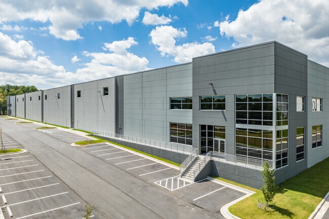
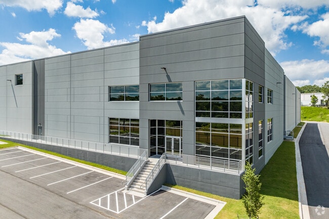
Property Record
3611 Jonesboro Rd Se, Atlanta, GA 30354
Current Lease Availabilities
NEARBY LISTINGS FOR SALE OR LEASE
Property Detail
3611 Jonesboro Rd Se
14-0034-0004-010-6
KA VACANT LAND GP OWNERSHIP VERIFIED 05 LAND SPLIT WRK FOR TXYR2018
Warehouse
Fulton
AE
Georgia
13063C0038F
10.89 AC
2023
Airport/North Clayton
2025
Atlanta
007301
Atlanta-Sandy Springs-Roswell, GA
171,183 SF
DEMOGRAPHICS near 3611 Jonesboro Rd Se
1 Mile
3 Mile
5 Mile
2024 Total Population
3,416
48,792
154,246
2029 Population
3,681
50,093
158,147
Pop Growth 2024-2029
+ 7.76%
+ 2.67%
+ 2.53%
Average Age
37
36
37
2024 Total Households
1,217
17,685
58,528
HH Growth 2024-2029
+ 7.89%
+ 2.81%
+ 2.77%
Median Household Inc
$50,118
$41,983
$47,838
Avg Household Size
2.70
2.60
2.50
2024 Avg HH Vehicles
2.00
1.00
1.00
Median Home Value
$183,689
$151,498
$209,390
Median Year Built
1970
1971
1973
Nearby Places
- Restaurants
- Banks
- Shops
- Fitness
- Groceries
PUBLIC TRANSPORTATION
AIRPORT
Hartsfield - Jackson Atlanta International
DRIVE
WALK
Distance
Hartsfield - Jackson Atlanta International
10 min
4.3 mi
Freight Ports
Georgia Ports - Savannah
DRIVE
WALK
Distance
Georgia Ports - Savannah
270 min
242.2 mi
Nearby Properties
Address
Land Use
TOTAL SIZE
Lot Size
Zoning
Address
Land Use
TOTAL SIZE
Lot Size
Zoning
200,000 SF
34.20 AC
HI
Address
Land Use
TOTAL SIZE
Lot Size
Zoning
318.25 AC
HI
Address
Land Use
TOTAL SIZE
Lot Size
Zoning
965,840 SF
1.50 AC
C
Address
Land Use
TOTAL SIZE
Lot Size
Zoning
65,458 SF
174.39 AC
C1
Address
Land Use
TOTAL SIZE
Lot Size
Zoning
1,113,792 SF
3.68 AC
CR
Address
Land Use
TOTAL SIZE
Lot Size
Zoning
54 AC
I2
Address
Land Use
TOTAL SIZE
Lot Size
Zoning
368,274 SF
171.85 AC
I1
Address
Land Use
TOTAL SIZE
Lot Size
Zoning
105.66 AC
HI
Address
Land Use
TOTAL SIZE
Lot Size
Zoning
513,124 SF
19.05 AC
I2
Address
Land Use
TOTAL SIZE
Lot Size
Zoning
278,866 SF
7.59 AC
CR
Address
Land Use
TOTAL SIZE
Lot Size
Zoning
113,364 SF
2.19 AC
I
Address
Land Use
TOTAL SIZE
Lot Size
Zoning
210,538 SF
101.40 AC
X
Address
Land Use
TOTAL SIZE
Lot Size
Zoning
382,918 SF
13.04 AC
CR
Address
Land Use
TOTAL SIZE
Lot Size
Zoning
298,264 SF
0.90 AC
C
Address
Land Use
TOTAL SIZE
Lot Size
Zoning
1,254,472 SF
0.49 AC
C1
Address
Land Use
TOTAL SIZE
Lot Size
Zoning
193,760 SF
14.46 AC
CR
Address
Land Use
TOTAL SIZE
Lot Size
Zoning
59,807 SF
43.70 AC
X
Address
Land Use
TOTAL SIZE
Lot Size
Zoning
123,747 SF
3.98 AC
Address
Land Use
TOTAL SIZE
Lot Size
Zoning
12 AC
R4
Address
Land Use
TOTAL SIZE
Lot Size
Zoning
402,544 SF
20.43 AC
I1
Address
Land Use
TOTAL SIZE
Lot Size
Zoning
1,740 SF
16.35 AC
MVEDU
Address
Land Use
TOTAL SIZE
Lot Size
Zoning
44,365 SF
17.77 AC
M
Address
Land Use
TOTAL SIZE
Lot Size
Zoning
474,830 SF
28.39 AC
I1
Address
Land Use
TOTAL SIZE
Lot Size
Zoning
96,028 SF
21.02 AC
I
Address
Land Use
TOTAL SIZE
Lot Size
Zoning
10.54 AC
Address
Land Use
TOTAL SIZE
Lot Size
Zoning
42.50 AC
HI
Address
Land Use
TOTAL SIZE
Lot Size
Zoning
836,904 SF
3.91 AC
CR
Address
Land Use
TOTAL SIZE
Lot Size
Zoning
86,071 SF
18 AC
M
Address
Land Use
TOTAL SIZE
Lot Size
Zoning
250 SF
13.40 AC
C
Address
Land Use
TOTAL SIZE
Lot Size
Zoning
166,108 SF
2.74 AC
CR
The World's #1 Commercial Real Estate Marketplace
Connect with us
© 2025 CoStar Group
The information above has been obtained from sources believed reliable. While we do not doubt its accuracy we have not verified it and make no guarantee, warranty or representation about it. It is your responsibility to independently confirm its accuracy and completeness. Any projections, opinions, assumptions, or estimates used are for example only and do not represent the current or future performance of the property. The value of this transaction to you depends on tax and other factors which should be evaluated by your tax, financial, and legal advisors. You and your advisors should conduct a careful, independent investigation of the property to determine to your satisfaction the suitability of the property for your needs.